NEW ON THE WALKING IN THE HAUTE-VIENNE WEBSITE
We spread paths and their rundown-index card having received the validation of the departmental Council of the Haute-Vienne. Paths are officellement feasible and marked out by the municipality and by the departmental Council.
The website has added new trails:
- le circuit de Noblat à Saint-Léonard de Noblat (The circuit of Noblat))
- le circuit de l'étang de Murat à Lussac-les-Eglises (The circuit of the lac of Murat)
- le circuit du Prince Noir à Lussac-les-Eglises (The circuit of the black prince)
- le chemin des deux moulins à Droux (The path of the two mills)
- Les Boucles d'Augne trail (The Augne loop at Augne)
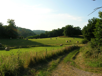
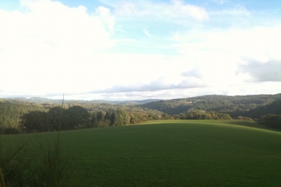
In the heart of Millevaches country, the circuit will take you on a journey through unspoilt rurality embellished by enchanting landscapes.
Access : 50 min from Limoges. Exit 35, direction Feytiat. Then to Eymoutiers via the RD979. In Eymoutiers, take the RD940 to wards Peyrat-le-Château then turn left onto the RD14 towards Augne.
Key points : The market-town of Augne and its church, the smallest in the Haute-Vienne; view points over the surrounding countryside; panorama of the Vienne gorges; typically built Limousin villages and buildings; sunken paths, small rural heritage (cross, fountains, washing places); you're in the territory of the Millevaches en Limousin Regional Nature Park.
- le sentier des Carrières à Nexon.
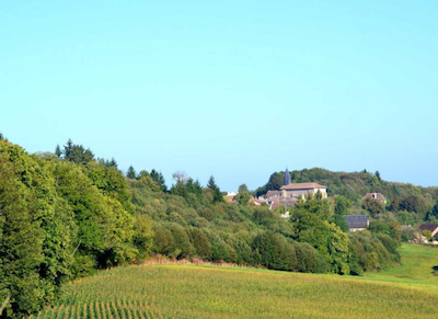
- le sentier "Sur les pas d'Henri de Navarre" à La Roche-l'Abeille (Following Henri Navarre)
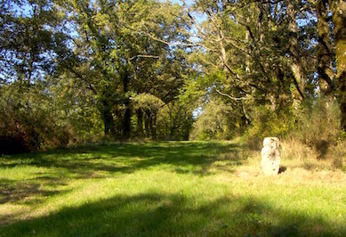
This 14-km trail offers numerous view points over the Limousin countryside. You'll visit the market-town of la Roche-l'Abeille, its 13th century church and its houses so typical in the south of the Département. Along the trail, traditional villages and hamlets offer walkers a rich, architectural heritage… another nearby trail, "The Serpentine trail", will take you on a discovery of the Saint-Laurent moor. This interpretation trail will explain the rich local fauna and flora. You'll learn how to recognise the famous serpentine; a very curious rock.
Access: 35 min from Limoges. Take the RD704 towards Saint-Yrieix-la-Perche. At the crossing, follow the RD17 to the left towards la Roche-l'Abeille.
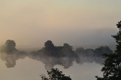
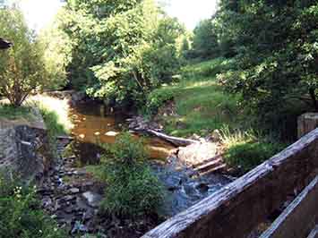
Key points: The market-town of la Roche-l'Abeille, its 13th century church; Claujoux stream, the lakes; the villages of Royères, Beauplas, l'Abeille, Gorce Mill; the lovely Cars fountains; the vie points of Puy Chétif.
- le sentier de la serpentine à La Roche-l'Abeille (The Serpentine trail)
This trail carries the name 'serpentine' because the moor's subsoil consists of serpentine, a low-acid rock in direct contrast to the region's granite. It's a striped rock that resembles a reptile's skin. The trail will take you to the Saint-Laurent serpentine moors containing highly original ecosystems that reveal a biological heritage of great rarity. There you can make great discoveries thanks to the interpretation trail of which the main theme is pastoralism. Interactive supports allow visitors to discover the natural and historical wealth of the moor. It's listed as a Natura 2000 site.
Bonne randonnée